I’d like to be able to say that my long-term memories from the recent regional ocean planning meeting in Gloucester would be the accomplishments and decisions made by the Regional Planning Body, as well as the good guidance provided by the gathered stakeholders. But, even as I sat there with the afternoon session winding down, I knew it would not be the content I would recall, but the sense of place* surrounding the meeting. The venue itself, the Greater Atlantic Regional Fisheries Office of the National Marine Fisheries Service, set the tone with its foyer’s ocean blue floor tiles, full-size sea life models, and fish mobiles.
My travel companion and I arrived in the neighboring town of Rockport the day before, and because of the late hour, soon set off from our accommodations to find dinner along the waterfront. While we walked down by the harbor filled with boats and past the shops and galleries, I became filled with a flurry of recollections of this same place, almost sixty years ago now, likely hand-in-hand with one of my parents, and I knew everything about it. It was still here, still recognizably the same place.
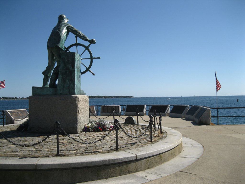
The next day a group of us headed out from the meeting to have lunch in town. We ended up circling the downtown streets and heading back through Gloucester’s waterfront, where again I was struck by a similar wave of recollections. The Harbor is still watched over by the “Gorton’s Fisherman,” minus the wooden draggers, but still filled with activity and exuding its strong identity. To most of us, Gloucester is the sea.
These towns have certainly evolved over the years, and I expect they suffered through many growing pains. The shops, galleries, and restaurants make evident the change of culture and economic drivers. I can’t help but think that the people of Cape Ann must have made a strong and conscious effort to maintain their wonderful sense of place throughout those changes.
Those of us working on various aspects of ocean planning would do well to take note, for it’s not always the new, larger, seemingly more productive and profitable entity or changes that fulfill our needs or satiate us as a society. Maintaining the balance and heritage as exhibited by these towns requires that we both recognize what stakeholders really want, and develop a decision-making process to carry it out.
During this past winter, I suffered back-to-back bouts of bronchitis, which, among other things, required a considerable amount of couch time. This was accompanied by a few episodes of the show “Dual Survival,” in which two intelligent, but quirky, outdoorsy types struggle to extricate themselves from some inhospitably wild and rugged terrain. A recurring theme and methodology they use is to find some high ground or climbable tree that makes it possible to observe their surroundings and assess their situation. From there, a decision can, and must, be made as to what direction to take.
The Northeast ocean planners have done, and continue to do, a great job collecting the data that gives us our observation point and establishes a baseline for where we are. It’s those decisions about what direction to head in that seem to give us the most trouble. How do we capture, as part of our data, the way fishing boats in a harbor can be the central theme or soul of a town, or the way nautical terms permeate our language? Why are these citizens of a New England town so reluctant to give up their seafaring heritage, and why is it still so intertwined in their economy? Many of the answers about what people in New England want, their “sense of place,” and what directions they prefer, were all around us on Cape Ann. We just need to appreciate what we’ve seen.
Maintaining the balance and heritage as exhibited by these towns requires that we both recognize what stakeholders really want, and develop a decision-making process to carry it out.
*Author’s note: “Sense of Place” was recently introduced to ocean planners as a factor used in establishing the Ocean Health Index, which hopes to track ecosystem health and the success of the Ocean Plan.
About the Author
Richard Nelson has been a commercial fisherman for over 30 years. He is a member of the Maine Regional Ocean Planning Advisory Group, the Maine Ocean Acidification Commission, and the New England Ocean Action Network. He lives in Friendship, Maine.
For more information about the Northeast Regional Planning Body or the Northeast Ocean Plan, see Rebecca Clark Uchenna’s blog piece, “Uncharted Waters: Next Steps for the Northeast Ocean Plan.”


