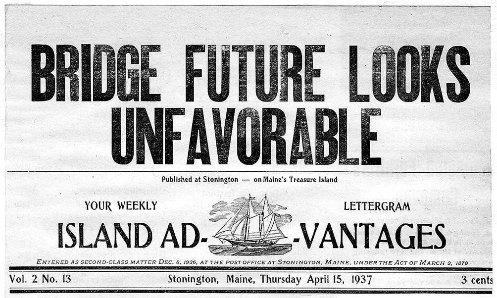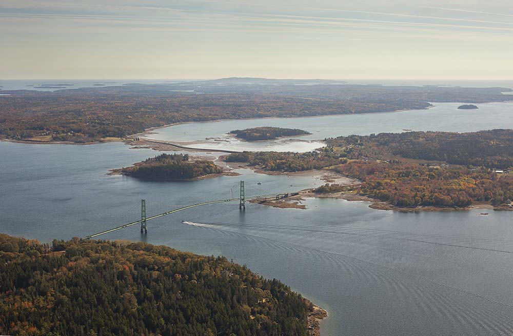
Does an island lose its “islandness” when a bridge is built linking it to the mainland? For Deer Isle and Little Deer Isle, the question is not hypothetical. For the last 75 years, a bridge has wrought changes to the two Penobscot Bay islands and to Stonington, the busy fishing harbor at their southernmost tip. Although the distance across Eggemoggin Reach from Little Deer Isle to the village of Sargentville is only half a mile, that gap seemed much greater until the Deer Isle–Sedgwick Bridge was built in 1939.
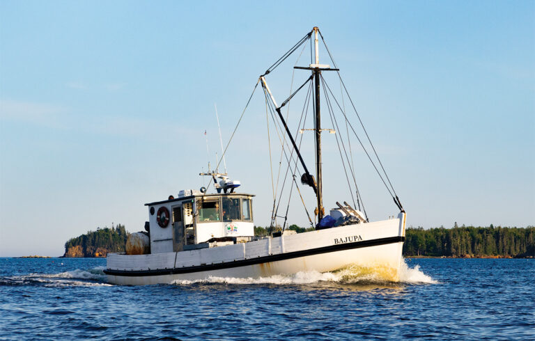
Before the bridge, most supplies came by steamer from Rockland, or by a ferry service operated by generations of the same family on Little Deer Isle. The bridge changed the region’s economy and culture. It changed the direction toward which residents looked for mainland connections, making it more part of the Blue Hill peninsula than Penobscot Bay. In many ways, it changed the island’s self-image. Although the bridge brought a freedom of mobility that allowed residents to join the 20th-century love affair with the automobile and the open road, Deer Isle was not exactly a remote, isolate outpost before 1939. Settlers began to arrive on Little Deer and Deer Isle before the Revolution. At the time the town was incorporated in 1789, it included Little Deer Isle, Deer Isle, and Isle au Haut, six miles to the south of Stonington at the southern tip of Deer Isle. In 1868 Isle au Haut became a separate town, and in 1897, the southern third of Deer Isle was incorporated as the town of Stonington. A ferry service linking Little Deer Isle to the mainland, documented in the Deer Isle–Stonington Historical Society’s records, began on April 17, 1792, when John Scott, son of an early settler, was employed by the town to row islanders across Eggemoggin Reach. In 1807, the town granted Scott $80 to construct ferry landings on both sides of the Reach. The Scott family’s ferry remained the chief contact with the outside world until the discovery of granite in the Stonington area in the mid-19th century. The small community on the southern end of Deer Isle, then known as Green’s Landing, thrived, and was incorporated into the town of Stonington. That development changed island transportation patterns. Steamers were soon transporting granite and carrying passengers and supplies west across Penobscot Bay to the rail link at Rockland.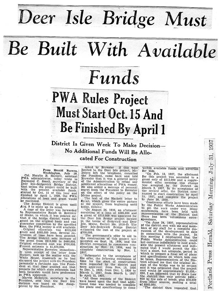
BEFORE THE BRIDGE
Hilda Eaton Stacher grew up on Little Deer Isle in the early 20th century. After graduating from the University of Maine, she returned to teach school on the island and run the Little Deer Isle post office. In 1989, she described life before the bridge in the local newspaper:
When I was growing up and we went to the mainland, we had to consider not only the departure time of the last ferry, but also the periods of low tide. One of the great frustrations of life was to arrive at the ferry landing and see the last ferry halfway across the Reach, heading towards North Deer Isle. We were also served by the Eastern Steamship lines, which operated between Boston and Rockland. Since the Reach usually froze solid in the winter, service was suspended until the first trip in the spring, which was often made while preceded by an icebreaker. Fortunately, island storekeepers usually laid in supplies of staples like flour and sugar for the long winter ahead.
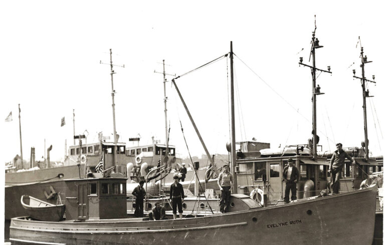
Cabbage “Cab” Haskell also grew up on Deer Isle, and provided a candid view of life before and immediately after the bridge was built: “The working-class people lived in Stonington and didn’t go to college. The Little Deer Isle folks went to college, were yacht captains, summer folks, etc.” He was even more blunt about the impact the bridge had on population: “It allowed folks to get the hell out of there,” he said. Haskell moved from the island to Philadelphia in the early 1950s, where he spent most of his adult life. Haskell kept a house on the island, however, and returned after his wife’s death. Everything depended on the steamboats from Rockland, he remembered, the north haven and the w. s. white, one of which came to the island once a day. “Before the bridge, Deer Isle was a foreign country,” he said. And in those early years of the 20th century, the Scott family ferry service lacked a measure of professionalism, he said. “If they didn’t like you, they wouldn’t take you,” Haskell claimed. He has no memory of traveling across on Scott’s ferry because his father and Scott didn’t get along. “He wasn’t a popular guy,” Haskell said of Scott. Haskell met his future wife Pam at a dance during those pre-bridge years. She was from Philadelphia, and her family summered on the island each year, driving to Deer Isle and coming over on Scott’s ferry. Haskell recalls that they had to get to the landing before it stopped running at 8 p.m. At the time Scott had a barge with a lobster boat tied alongside that took four cars at a time.
A BRIDGE IS BORN
Haskell said the bridge was built for commercial purposes. “A bunch of prominent businessmen saw it as an opportunity to transport freight on and off the island more easily, and to get stones from the quarries to the mainland faster,” he said. And the timing was right. In those Depression days of the 1930s, federal money was available for public works projects, through the Works Progress Administration (WPA) and the Public Works Administration (PWA). But the idea of the bridge was born well before President Franklin Roosevelt’s recovery programs took shape. During the 1920s, local and regional leaders hosted meetings to talk about upgrading the ferry service, but those efforts were only partially successful. Charles Scott attempted to respond to concerns by adding larger scows capable of carrying up to six cars. In 1927, he added a second towboat. Another development that same year brought the bridge idea closer to reality. Representative George E. Snowman, the state legislator from Little Deer Isle, introduced a bill to build a causeway at Scott’s Bar, connecting that island with the larger Deer Isle. Snowman’s proposal won passage, and $15,000 was allotted for the project. The causeway was begun that year, but not completed until 1938. The state transportation department added locally quarried stone barriers to the sides in 1946.
BRIDGE OR FERRY?
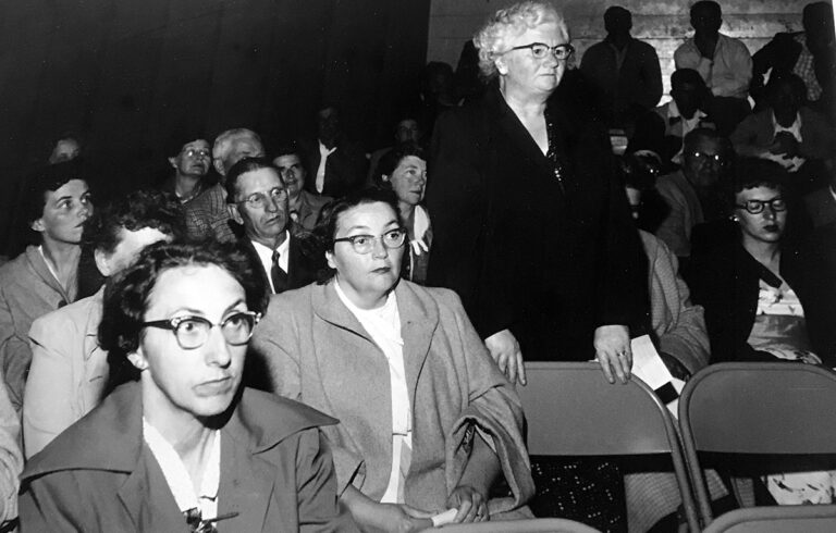
During the next few years, the bridge question became the hot topic of discussion. Not everyone favored it, with the cost a major concern. Why not simply improve the ferry service instead? By 1933, however, the opposition to a bridge had begun to dwindle. “Upgrading the ferry service was a difficult proposition during the depths of the Depression,” said island historian Clayton Gross. “Large amounts of capital were needed to construct a new ferry.” And if it were built, weather would still hinder reliability, he said. That case was made in March 1933 when several cars arrived on the mainland side of Scott’s ferry at Sargentville only to find it not running because of high winds and rough seas. Drivers waited all day before returning to Blue Hill to spend the night. The next day they returned at 8 a.m. and were forced to wait until 3 p.m. before the ferry was finally able to take them across in very bad weather. Clearly the ferry service had become outmoded. During the winters of 1934 and 1935 it was frequently inoperable because of severe weather conditions. And it was more than cars. Ice prevented steamers from bringing fuel to Stonington. It was of little consolation that the Reach was frozen so solidly that adventurous drivers were able to drive across in those years. Alternatively, in the summer as many as 40 cars at a time could be seen lined up at Sargentville waiting to get to the island. Something had to be done. In December 1933, Stonington, Deer Isle, and Sedgwick each appointed two trustees to form a bridge commission. The following summer they visited Governor Louis Brann to lobby for his support. The next year, Brann signed a bill creating the Deer Isle–Sedgwick Bridge District, although it would be five years before a firm commitment was made to construction. Financing, location, design, and winning public support were the next challenges. More than once, it seemed the idea had died. Committees were formed, studies were made, and, as one newspaper article noted, “he bridge project was kicked from one end of the state to the other as being a worthless and expensive proposition beyond reasonable realization.” Finally, in 1935, Bridge District president Frank McGuire secured two large PWA grants, the cornerstones on which the bridge would be built. Authorization for a $500,000 bond required a statewide referendum, and it was put on the ballot in 1935. At the time there were 426 cities and towns in Maine, and the bridge trustees spent endless hours visiting more than three-quarters of them to make their case. When the votes were tallied, the project was approved by a ratio of three to one. Then in November 1936, McGuire, a tireless worker for the project, suddenly died. His obituary noted, “He had laid a firm foundation which weathered many a storm.” His place was taken by Stephen Knowlton, who also would die before the bridge was completed. Although the federal government supported the project, its engineers initially insisted that the bridge be of a sufficient height for large ships to pass beneath. This meant a clearance of 100 to 110 feet, which would have added considerably to the expense and further complicated the design. A. Cressy Morrison, a prominent scientist and author of the day who owned a small island off Stonington, was enlisted to lobby for a lower bridge height. (Local lore holds that the Rockefellers on nearby Mount Desert Island wanted the bridge high enough so their sailing yachts could cruise Eggemoggin Reach.) After considerable discussions with the War Department and WPA offices in New York and Washington, Morrison was able to secure approval for a bridge with 85 feet of clearance off the water, which was still high enough for pleasure yachts to sail under. The Deer Isle–Stonington Messenger noted, “We are indebted to Mr. Morrison for his timely assistance and efficient work.” Bonds were issued, bids accepted, rejected, revised, reopened, and extended. The Messenger, in understated terms, summarized the process, saying: “The vicissitudes which the bridge project went through were many.” In October 1937 final bids were opened and came in under the projected cost. After 16 failures and revivals, the bridge was finally to be built.
CONSTRUCTION COMMENCES
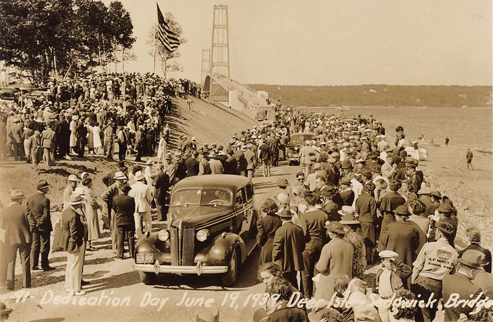
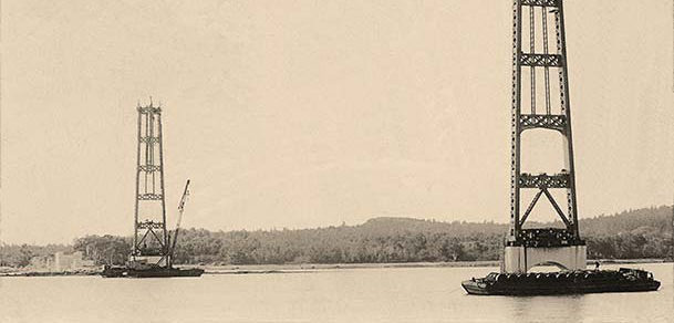
The contract for the substructure—the piers on which the towers would stand—was given to Merritt-Chapman & Scott of New York. The superstructure work was awarded to the Phoenix Bridge Company of Phoenixville, Pennsylvania. Despite frequent bad weather, work proceeded throughout the winter of 1937–38. Divers made test borings and cleared mud from the proposed pier locations in the waters between Sargentville and Little Deer Isle. Prefabricated iron forms were built to fit the rock formations at the site of the piers. Derricks lowered each section into place, and the seawater was pumped out, creating what is known as a cofferdam. These structures were then filled with concrete, forming a foundation for the bridge. Each of the bottom sections weighed about 135 tons. It was estimated that the job would employ 50 men working in two shifts. Additional work was announced for local residents, although not as much as originally promised, causing some initial unhappiness. By the spring of 1938, however, three shifts of men, including many previously unemployed from the area, were working around the clock to pour the 1,800 cubic yards of cement that it took to fill each of the cofferdams that formed the piers. Clayton Gross described the scene: “One of the things which seemed to impress people about bridge work was the appearance of the Reach at night. It was variously compared to a World’s Fair or to a major port, when the fleet was in, the area was so brilliantly illuminated by floodlights.” The steelwork and the cables connected to the towers were also prefabricated. The cables were spun on-site on large spools and stretched across the Reach. Girders for the suspension span floor were cut and put in place beginning with the center section. During the two years the bridge was under construction, there was one fatal accident and a number of minor delays due to winter storms. For the most part, however, construction proceeded on schedule. By October 1938 the bridge towers were completed, and in March 1939, the last span was connected to the tower on the Deer Isle side. In May 1939 the steelwork was completed, and in June, the bridge was opened to traffic. The dedication of the Deer Isle–Sedgwick Bridge took place on June 19, 1939, when Maine governor Lewis O. Barrows cut the ribbon stretching across the entrance to the $900,000 project. Bands played, automobile horns honked, and thousands of spectators roared their approval. Oscar Shepard wrote in the Bangor Daily News, “As the bright bit of silk touched the floor of the bridge, it was an island community no longer.” Barrows gave the keynote address, and speaker after speaker paid tribute to the spirit of the individuals who had made the bridge a reality. Congressman Ralph Brewster summarized the import: “After 175 years of geographical isolation, Deer Isle today becomes a part of Maine and of America. The union fulfills the dream of many men for many years.” In his 1989 history of the bridge, Gross wrote, “The construction of the Deer Isle–Sedgwick Bridge was probably the single most significant event in the history of Deer Isle.” The bridge motivated “an influx of retired people, a marked increase in the number of summer residents, larger numbers of transient tourists and young people who have vocations at which they can make a living. All of this has brought a change in the fabric of the island community.” In 1989, Hilda Eaton Stacher was even more succinct: “We are no longer an island,” she wrote. “How thrilled we were to see the president’s yacht, with FDR on board, sail under the bridge in 1940. It was just after he had the historic meeting with Winston Churchill off of Newfoundland . . . The island didn’t change drastically at first, though little by little we noticed changes.” The Deer Isle–Sedgwick Bridge was of a slender design similar to that of the ill-fated Tacoma Narrows Bridge in the state of Washington. That bridge, known as “Galloping Gertie” because of its “bounce,” collapsed in 40-mph winds on November 7, 1940. News of the catastrophe made Deer Isle folks uneasy, since their bridge over Eggemoggin Reach was also very sensitive to windy conditions. In December 1942 the Deer Isle Bridge faced its own ordeal. Seventy-mile-an-hour winds caused the bridge to oscillate so violently that many of the cable stays snapped, steel girders cracked, and general havoc was wrought. Bridge engineer David Steinman responded by adding a veritable cat’s cradle of stays that ran from the tops of the twin towers to the cables to the roadway. As a child, island resident Bill Haviland remembers that it was fun to walk out on the bridge on a windy day and feel it sway under him. Over the years the bridge would be closed periodically due to “undulations blamed on wind and heat,” Haviland recalled. The bridge has remained vulnerable to weather conditions, and has needed to be patched and repaired by cables and braces to protect it from gusts and gales.
TOLL AHEAD
For over 20 years bridge tolls were considered prohibitively expensive, and were an ongoing cause of irritation to islanders. The round-trip toll of $2 represented a significant portion of a paycheck when many people were earning less than $30 per week. Haviland remembers his father telling them as children to get down behind the seat when they came up to the tollbooth to avoid the extra passenger charge. And the $2.50 charge for trucks discouraged land shipments for years. As a result, for a long time after the bridge was built, granite still was shipped by barge or schooner to Boston or New York. Then there’s the story of two drunks who drove up to the bridge and tried to cross without paying because they were broke. They were stopped when their car hit a fence just past the tollhouse. The toll collector later said, “If only they’d told me they didn’t have any money, I’d have let them across.” Tolls were gradually reduced until, in 1961, an irate crowd of islanders packed the Legislature’s Highway Committee hearing room in Augusta to lobby for the final removal. In the face of heavy pressure, a bill was passed, removing tolls from the bridge on September 15, 1961. Driving over the 2,308-foot span is like going up and down a small hill. Bill Haviland tells the story of when his two aunts visited from New Brunswick in the 1940s. As they approached the span they thought it was a drawbridge that was raised. They waited for 15 minutes before realizing their error. Although the Tacoma Narrows Bridge tumbled into Puget Sound in 1940, just a year after both bridges were built, three-quarters of a century later, the East Coast cousin remains sensitive to wind conditions but still spans Eggemoggin Reach. With a few exceptions, all the goods and services for Deer Isle cross the bridge. While Stacher was technically accurate in her “We are no longer an island” proclamation, much of the special, old-Maine quality of life remains, as visitors and residents well know.

