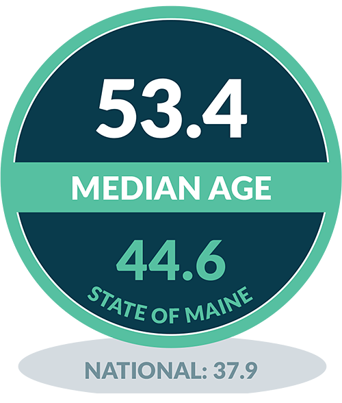
QUICK FACTS
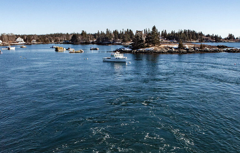
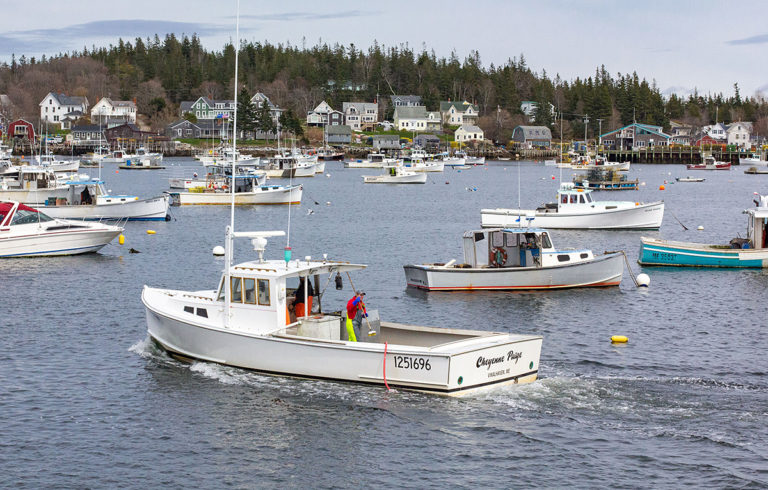
Vinalhaven is located in Penobscot Bay with 24 square miles of land. Over 3,800 to 5,000 years ago, the island was inhabited by the Red Paint People and later by the Abenaki. Beginning in the 18th century, Europeans arrived on Vinalhaven to quarry the granite. Vinalhaven granite was used in the construction of the Church of St. John the Divine and the Brooklyn Bridge in New York. Today, Vinalhaven is distinguished by its thriving lobster industry and busy Main Street, known as Downstreet.
COMMUNITY HIGHLIGHTS
- Island Farm Project
- Bean Suppers
- Brown’s Head Lighthouse
- Community Night
- Downtown Main Street
- Flea and Farmers Market
- Fourth of July Parade
- Lane’s Island
- The Basin
- Swimming Quarries
- Vinalhaven Galamander
- Vinalhaven Historical Society
- Vinalhaven Land Trust Trail System •
- Vinalhaven Medical Center
- Vinalhaven Public Library
- Working Waterfront
ECONOMY
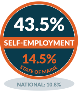
43.5% The economy of Vinalhaven is largely defined by the fishing industry,
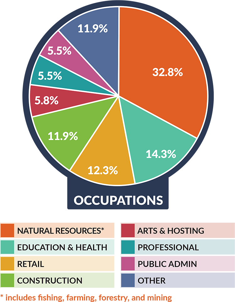
particularly lobstering. Lobster landings on Vinalhaven have consistently been the second highest by pound in the state of Maine. Fishing and the beauty of the island encourage many visitors to make the trip across the bay from Rockland. The population swells in the summer months to around 4,000 people, making for a very seasonal tourist economy.
SCHOOL SYSTEM
Vinalhaven School is the largest unbridged island school in Maine. Students can pursue many extracurricular activities including organized sports (soccer, basketball, baseball, and softball) and after-school groups such as Model UN, theatre, and LEGO Robotics. The students’ education is enhanced by the 12.3% island geography through hands-on classes on growing kelp, aquaponics, environmental awareness, and field trips to surrounding islands and nature preserves.
LOCAL INFRASTRUCTURE
Sea Level Rise:
Since 2016, Vinalhaven has been addressing the effects of sea level rise by first understanding the impacts
of flooding, storm surge, and rising tides through modeling and local data collection. Working with a number of invaluable partners, the town’s active Sea Level Rise Committee is developing recommendations to incorporate sea level rise into municipal planning and infrastructure adaptation.
WORKING WATERFRONT
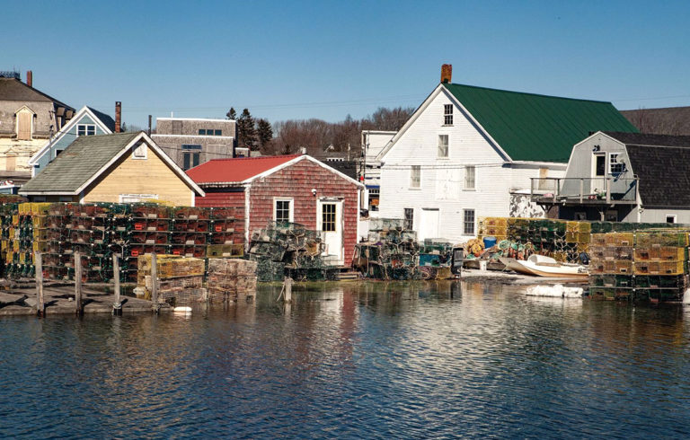
Vinalhaven is home to one of the state’s most profitable harbors by way of its landings. Lobster fishing is estimated to employ over 500 people on the island and the need for access is critical. The town maintains three public access locations in Carver’s Harbor. For the most part this provides sufficient access for fishermen, although public access to the water is still lacking. Recommendations in the Downtown Master Plan will help guide decision-making in the near future to preserve and potentially increase access.
SUSTAINABLE ENERGY
Fox Islands Electrical Cooperative provides electricity for both Vinalhaven and North Haven. In 2009, the Coop installed three 1.5 Megawatt turbines on Vinalhaven. They generate 10,723 megawatt hours representing 95% of the island’s annual electricity use.
Downtown infrastructure
Vinalhaven’s five- to ten-year Downtown Master Plan (October 2019) includes capital improvement and ordinance recommendations which address sea level rise and year-round Main Street vibrancy, while reflecting the community’s need for increased safety, accessibility, housing, and waterfront access.
Broadband connectivity
The Select Board has identified broadband as a community priority, and the town is conducting a feasibility study to determine a viable business model for a fiber-to-the-premises network. From there, the community will be able to determine how and when they can implement an equitable and adequate system.
Vinalhaven Community Profile Video
How to get there
Vinalhaven Island is serviced by the Maine State Ferry Service, which departs from Rockland. The 1 hour and 15 minute ride arrives into Carver’s Harbor on the south end of the island, just a quarter-mile walk to downtown. Vinalhaven has six round-trip ferry runs each day year-round. During the winter months, however, the last trip to and from the island departs at 3:15 pm rather than 4:30 pm during the summer.
FORE MORE DATA ON MAINE’S ISLAND AND COASTAL COMMUNITIES VISIT:
www.islandinstitute.org/waypoints
FOR DATA QUESTIONS, CONTACT:
info@islandinstitute.org

