The Maine Department of Transportation is moving forward with plans to replace the 90-year-old dike and bridge that carries Route 1over the Middle River in Machias, but new concerns will mean a more careful consideration.
Late in March, the department held a virtual public meeting to explain and solicit public comment on the project that will entail the replacement of the approximately 1,000-foot causeway that carries not just the highway, but also a section of the Downeast Sunrise Trail that runs along a former railway roadbed and extensive utilities infrastructure including water and electric service among others. The dike also provides a parking area and space for a seasonal farmers market in Machias.
The first dike was built about 1868, but the current structure, built of timber cribbing with rubble and earthen fill, dates to 1930 and was widened in 1944.
Over time, areas above the dike that once were salt marsh have grown up into wetlands…
The dike is pierced by four timber culverts with tide gates installed some 70 years ago that prevent the inflow of tidal water from the Machias River to the land above the structure while allowing the outflow of water from the Middle River. Over time, areas above the dike that once were salt marsh have grown up into wetlands that have supported farming and recreational uses.
DOT has determined that the dike and tide gates have outlived their design life, no longer function properly, and need to be replaced. The question is, replaced with what?
In 2009, when DOT first addressed the issue, the answer seemed to be to replace the failing dike with another similar structure. Nothing was done and now things have changed.
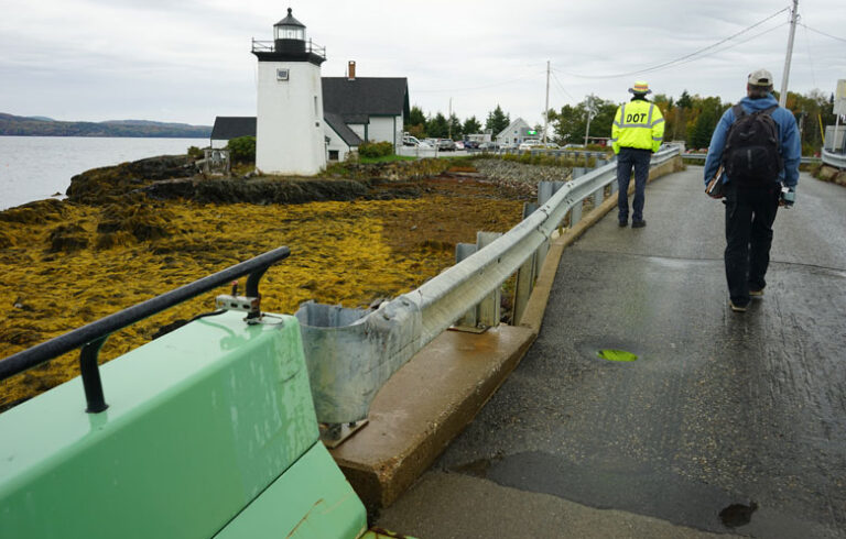
First, as part of a flood mitigation study in 2018, the town of Machias determined that it should build a seawall along the Machias River to protect the downtown area from flooding by a projected sea level rise of about three feet. The outer end of that seawall would terminate at the dike. In recent years, DOT has had to plow seaweed deposited by high tides off Route 1 where it crosses the dike several times.
Second, last August, the federal environmental agencies that would have to issue permits for construction of the new project determined that any replacement structure will have to provide for adequate upstream and downstream fish passage for migratory fish, including the endangered Atlantic salmon.
DOT is now exploring alternatives to construction of a replacement for the dike that will address both the issues of fish passage and sea level rise. While the department offered several options at its public meeting in March, Dwayne Shaw, executive director of Downeast Salmon Federation said the organization would be asking that DOT replace the dike with an open span bridge that would allow free tidal flow into the Middle River watershed. The department already appears to favor this alternative for replacement of a similar dike and tide gate structure in Addison.
“This potential marsh and watershed restoration/barrier removal project is ranked among the top ten estuary restoration projects in the entire Bay of Fundy and Gulf of Maine,” Shaw said in a statement. “Not only do the tide gates impact hundreds of acres of saltmarsh, they are also a barrier to migratory fish and exacerbate tidal flooding in other nearby sections of downtown Machias.”
Public comment on DOT’s initial presentation of the proposed project closed on April 30, but the public will still have plenty of opportunity to weigh in on the project. The March public meeting can be viewed on the DOT website at meetings.mainedotpima.com. The department also plans to hold another public meeting in September which will allow for comment on a narrowed list of alternatives.
According to DOT Project Manager Nathan Howard, the department hopes to announce a “preferred alternative” for the project in March of next year and begin the design process in June.


