Salt marshes comprise more than 22,000 acres, or 34 square miles, in Maine. These ecosystems provide myriad ecological and climate services, such as habitat for wildlife, including endangered species, buffering of coastal flooding, and carbon sequestration. But, if you aren’t a bird enthusiast, waterbird hunter, or a marsh ecologist, you may not pay much attention to these tidal wetlands.
The next time you pass the Taste of Maine restaurant on Route 1 in Woolwich, notice how the road dips down between two marshes that look remarkably different. The difference results from the extremely small culverts in the road that severely restrict the exchange of tidal waters.
Tidal restrictions alter the biological characteristics of a marsh, and can reduce tidal sedimentation, impair marsh peat accumulation, and cause peat subsidence, each of which undermines the ability of marshes to keep pace with rising seas.
It is a lot less costly to invest in structures that will perform well during their entire service life, rather than to have to fix or replace them…
Hindered flow can also interfere with marsh carbon dynamics. Some scientists liken the complex carbon dynamics to “the breathing” of the salt marsh, where they suck up carbon dioxide and, in some cases upstream of a restriction, actually become net emitters of methane, a potent greenhouse gas.
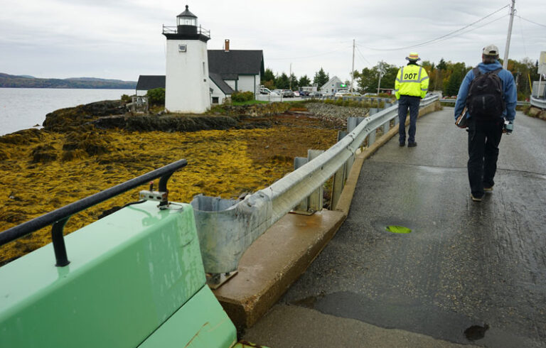
There are over 800 tidal road crossings in Maine, 90 percent of which restrict flow and alter the natural composition of tidal wetlands, including not just salt marshes, but also clam flats and hard bottom habitats. You can peruse present tidal restrictions (culverts, bridges, dams, etc.) and future tidal crossings (under sea level rise) in Maine Coastal Program’s Tidal Restriction Atlas.
Maine Coastal Program conducted a statewide assessment of every tidal road crossing using satellite imagery and historical data sources, such as 150-year-old charts to identify restrictions and changes in habitat. While roads are the cause of the vast majority of restrictions, other causes were also identified such as old railroad bridges built up onto solid embankments, dykes, and tidal dams.
Importantly, most of these roads were not designed to withstand increasing coastal flooding. Sea level rise, storm surge, and more frequent intense precipitation events all put this infrastructure at risk and can lead to interrupted access and higher than anticipated maintenance costs.
But a pioneering program to improve the process of updating road crossing infrastructure in tidal ecosystems is under development right here in Maine. The “CoastWise Approach” is a collaborative effort with over 30 partner organizations, led by Maine Coastal Program and a steering committee with representatives from U.S. Fish and Wildlife, Wells National Estuarine Research Reserve, Casco Bay Estuary Partnership, Maine Coast Heritage Trust, The Nature Conservancy, and NOAA’s Office for Coastal Management.
The CoastWise Approach provides a voluntary set of best practices based on the latest science and aggregated knowledge of experts in Maine and other states. Considering that many of these structures will be in place for 50 to 75 years, it is a lot less costly to invest in structures that will perform well during their entire service life, rather than to have to fix or replace them in the near future.
Many coastal municipalities have a lot of road miles that are not state roads. They are either town-owned or private. In Harpswell, for example, 63 percent of the roads are private. Every wetland road crossing is different, with the tidal nature of the flow adding to the complexity.
Thus, the methodology outlined in CoastWise is particularly conceived for municipalities, private road owners, and their engineers to navigate the intricacies and uncertainties of working in rapidly changing coastal environments, ultimately resulting in crossings that are safer, climate resilient, more cost-effective, and ecologically sensitive.
According to CoastWise Project Manager Slade Moore there is a sense of urgency.
“With the rate of sea level rise increasing, we have a narrow window to act on behalf of at-risk coastal communities and impaired habitats. Awareness is increasing,” he says, “but this stuff is still new to most people, and we’ll need to identify dedicated, long-term funding sources to achieve meaningful gains in fixing a problem hundreds of years in the making.”
So, the next time you are driving along the coast of Maine, mix it up a little and instead of travel bingo or “I spy,” consider “count the crossings” or “rate that restriction” and give a shout out to the innovative designers of the CoastWise Approach.
Susie Arnold is a marine scientist with the Island Institute, publisher of The Working Waterfront, working on the impacts of climate change and ocean acidification on marine resources and fisheries-dependent communities. She may be reached at: sarnold@islandinstitute.org.


