When then-Gov. Angus King coined the “Maine… The Way Life Should Be” slogan, a friend in Belfast manufactured coffee cups that included the phrase on one side. On the other side, it read: “Belfast… The Way It Is.”
If those Jeff Dobbs aerial videos in which stunning footage reveals the beauty of the state’s coast are the first part of that pairing, U.S. Route 1 is “the way it is.”
For much of the 20th century, Route 1 was the way to engage with the state’s coast, the main artery linking locals and visitors to its economy, culture, and recreational opportunities.
Route 1—or, its more lyrical appellation, the Atlantic Highway—stretches from Key West to Fort Kent, 2,446 miles in all. It traces its beginnings to coastal trails along the 13 colonies.
In an Aug. 19 virtual lecture for the Boothbay Region Historical Society, Earle Shettleworth, former director of the Maine Historic Preservation Commission and past president of the Maine Historical Society, told the story of “Roadside Maine: U.S. Route 1, 1900-1950.”
“All of this took place—this massive development, this change—because of the development of the automobile,” he said of the Route 1 we know today.
The automobile brought dramatic change to the way the growing middle class vacationed, and Route 1 was remade to accommodate that change.
Before World War I, Shettleworth said, those who could afford to leave urban areas in summer would travel, often by train, to a resort—the Poland Spring House, the Samoset, Mount Kineo House—for an extended stay. But when driving from Boston to Maine was within reach both financially and geographically, cabins and motels began being built.
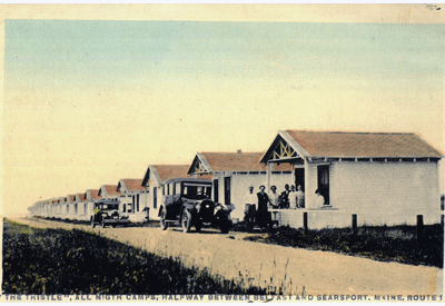
Amenities like electric lights, toilets in every cabin, running water, Simmons mattresses, and linoleum floors were advertised.
Though Maine often is late to the dance on trends, cars “took hold in Maine very rapidly,” Shettleworth said.
The state was publishing “Auto Maps of Maine” as early as 1920, seeing cars and highways as opportunities for economic development and tourism. The map “boasts the fact that Maine is open for business, that Maine has all these navigable roads,” a status not universal in those years.
Shettleworth used a series of postcards and photographs from the first half of the 20th century to show the evolution of the highway.
One from 1923 showed Route 1 crossing from Portsmouth to Maine on the “new” bridge, with towers that lifted a middle section to allow ship traffic upriver.
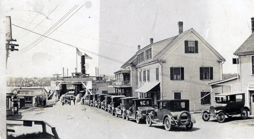
A 1940s image showed the Maine Information Center in Kittery, a neo-Greek building on Route 1. “By the 1940s, the ‘50s, you were greeted by the Maine Sardines sign, also in Kittery,” he said, showing an image of the 40-foot-high fisherman holding a can.
A photo showed the Chelsea State of Maine cabins in Kittery, with a row of small buildings. Visitors didn’t want the formal nature of hotels, he said, so “You would chart out a route for your vacation and go from place to place.”
Amenities like electric lights, toilets in every cabin, running water, Simmons mattresses, and linoleum floors were advertised.
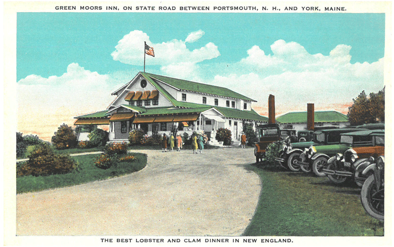
The Green Moor Inn in York advertised $2 lobster and clam dinners; Eaton’s Campground and Cabins, also in York, offered tent sites. Both were shown in photos from the late 1920s or early 1930s. Shettleworth said the more adventurous travelers would carry a tent in their car on their journey to Maine.
It was in the 1930s that chain motels began to appear. A Howard Johnson’s in Wells opened in 1938, “part of a group that opened that year in Maine.” The photograph shown was of an attractive colonial building with a cupola and steep-pitched roof.
After World War II, offerings became more varied. Attractions like the Animal Forest Park in York opened. In 1938, the Ogunquit Playhouse opened on Route 1, hosting shows with contemporary movie stars. And motels began building pools.
It was after the war that motels—cabins joined together as a “motor hotel”—became the norm. Even as pools and motels became popular, visitors had a soft spot for the quaint and historical. “Antiquing became very popular in the period,” Shettleworth said, showing a photo of a colonial era house with old chairs for sale on the lawn.
Along with cabins and motels, “tourist homes” began to appear. “People had big, old farmhouses, and maybe they weren’t productive as a farm so they would turn them into tourist homes.”
When it became clear travelers and their dollars were up for grabs on Route 1, businesses stepped up their game, he said. “Billboards began to appear right after World War I along Route 1 and continued into the 1970s,” when they were banned by state law.
Fast food came in the form of diners.
“These were based upon the very popular dining cars on trains,” he said. The White Cap Quick Lunch in Yarmouth, pictured in the 1940s or ‘50s, was shown as an example. Inns began to offer dining, too. One “Trav-O-Tel” featured a sign that read “The fish you eat here today slept last night in Casco Bay.”
As tourist traffic grew, transportation planners saw obstacles posed by “the reality of Maine topography—the great rivers.” So rather than have a ferry crossing from, for example, Bath to Woolwich, bridges were built.
Later, the economic blessing of Route 1 began to be seen as a threat to community character, and bypasses were built to carry the road around Waldoboro, Damariscotta, Rockport, and Belfast. In the mid-1930s, Moody’s Diner and Cabins were built where the bypass and the original Route 1 in Waldoboro intersected.
Construction of the Maine Turnpike “would, in some ways, alter the course of Route 1,” Shettleworth said. “You could avoid Route 1. Now you had a choice.”
