Reflections is written by Island Institute Fellows, recent college grads who do community service work on Maine islands and in coastal communities through the Island Institute, publisher of The Working Waterfront.
I decided to pick up a copy of the Maine Atlas and Gazetteer on my way to the Island Institute Fellows orientation last summer with the goal of navigating without a GPS in this new phase of my life. As a 22-year-old recent college grad who learned to drive with the novelty of a GPS on my phone, this felt like a pretentious and potentially dangerous, but altogether fun endeavor.
My mom chuckled at my decision, mentioning how much it reminded her of my father, who didn’t trust Google Maps until a couple of years ago.
Much like him, I presume, I felt having to rely on a physical map would help me better understand my new home in Washington County. It might even make me more readily able to fit in with folks who have lived here their whole lives.

After arriving to many meetings late, getting used to asking for directions in terms of turns on specific roads rather than addresses, and realizing how woefully oblivious I was to my surroundings while driving, I finally felt like I figured out the general gist of my landscape. But my experience of connecting with this place and beginning to call it home didn’t stop there.
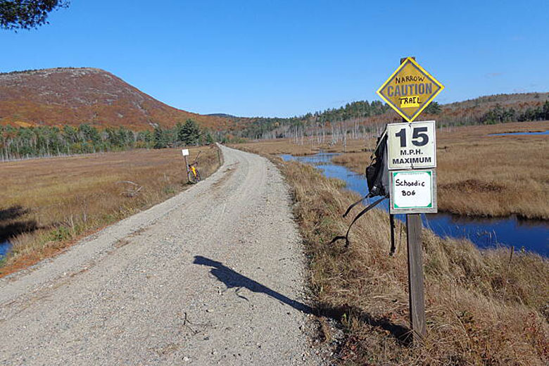
In rural places, trails can make up a substantial part of the fabric of the community. Whether it’s hiking trails, ATV and snowmobile trails, rivers to paddle on, or dirt back roads, there is little that you can’t find in the wilderness.
A large part of the identity and culture of Washington County is entwined with outdoor experiences, whether you’re working, recreating, or hunting. My position with the Sunrise Trail Coalition takes me from measuring sidewalks in Dennysville for a village access plan to scouting out town parks in Franklin for our new trail map, to watching out for beavers and moose on the trail itself.
The trail is long, and my position is regional, which means that I work with many communities throughout Hancock and Washington counties. But I find that this place—this earth, these streams, these blueberry fields, and these fir trees—make it all feel like home.
And from the many pictures of old railroad trestle bridges I have seen, the accounts of folks coming up to visit to use the trail year after year, and the smiling faces I see walking on the trail from town, I know our trail users feel it too.
I’ve started helping out with the Dennysville ATV and Snowmobile Club’s monthly community breakfast every so often. I’ve found comfort in turning out blueberry pancakes for hours in a small kitchen with women who I’ve gotten to know through the chatter of early morning crude jokes and laughs. I’d like to say that I do it just to help out, but it really is a great way to get in on the town gossip. And, it’s nice to be surrounded by people who show up for their community, no matter how early it is or how many dozens of eggs have to be scrambled.
Developing a relationship with place has never felt so easy until I moved Downeast. Maybe it’s not that the land or the people are wholly different from the places I’ve lived before. It might be that I’m able to be more open to the watching, observing, and listening that’s necessary for loving.
Lavinia Clark works with the Sunrise Trail Coalition to engage communities with the trail for transportation, recreation, and community building. Originally from Bethel, she graduated with a degree in environmental studies from Boston College.